Zoom
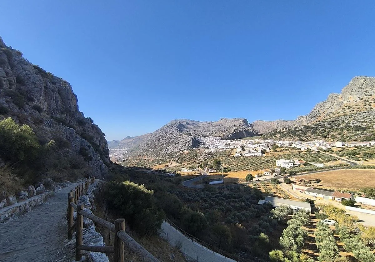
Benaoján on the left, Montejaque on the right SUR Walking routes Keeping an eye on the neighboursBenaoján and Montejaque; El Borge and Almáchar; are examples of towns that are just a stone's throw away from each other
Javier Almellones
Friday, 9 January 2026, 15:59
In Malaga there are villages so close together that you don't need a car: you can walk through them, almost as if you were passing from one street to another. In the Serranía and Axarquía, some villages are separated only by two kilometres, with landscapes and historic routes that today families can stroll through. In this province, the border between one village and the next is blurred: from the Guadiaro valley, to what is known today as the Corazón Moscatel, the distances between them are short and the journey becomes a walk, which can be done on foot. On some routes, there are even footpaths for this purpose.
Benoaján and Montejaque
There's hardly two kilometres between Benaoján and Montejaque, a half-hour drive along the MA-8403, that feels almost like a country road between olive groves and limestone hills.
Benaoján's centre is about 569 metres above sea level, while Montejaque rises to about 690 metres, which explains the slight slope from south to north and the increasingly open views facing the mountain range.
Between them, the combined population of the villages is no more than 2,500, but they share the same landscape and proximity.
They are linked together by the limestone that borders the Llanos de Líbar and by the river Gaduares, which forms the exceptional Hundidero-Gato cave complex - named after two caves located in different municipalities.
El Borge and Almáchar
Between the municipal swimming pool in El Borge and the María Zambrano park in Almáchar, there are hardly two kilometres. It is just over a 20 minute walk along the MA-3100, through muscatel vineyards and orchards.
Almáchar, with a population of just under 2,000, sits at around 250 metres above sea level, and El Borge, with around 1,000 residents, is at a similar altitude.
In addition, the Gran Senda de Axarquía (GR-242) links both villages, taking advantage of the usually dry riverbed to offer a hiking route that is well integrated into the landscape.
Both villages, together with Moclinejo, a little further away, form part of the Corazón Moscatel tourist route, creating a synergy that revolves around the raisin culture in this landscape centred on vineyards and wine presses.
Árchez, Canillas de Albaida and Cómpeta
On the south side of the Almijara mountain range, there are three villages that almost touch and can be covered in a single walk: From Competa a route that is part of the Gran Senda de Malaga links the Almijara square with the hermitage of Santa Ana.
From Canillas to Archez, the circular Los Molinos route descends through orchards and irrigation channels to the Turvilla river, linking old mills and a unique Nasrid heritage.
With just over 3,500, 700 and 400 inhabitants respectively, and an altitude of around 630 metres for the first two and around 530 for the latter, this triangle is experienced almost as a single destination.
There are many possibilities: a medieval bridge, an ancient minaret, a Roman road and thrilling climbs to the peaks of the Almijara mountain range.
Alfarnate and Alfarnatejo
In the Upper Axarquía there are also two mountainous villages side by side.
Alfarnate, with just over 1,000 inhabitants, sits at an altitude of around 890 metres, while Alfarnatejo, with 370 inhabitants, is at around 850 metres, which gives it a cool breeze, even in the summer. There is no traditional urban road between the two villages. What there is, however, is a historic connection on foot via the Puerto del Malinfierno pass, a natural pass that forms part of the Gran Senda de Malaga (GR-249) and the Bosque de las Morillas trail, which links them through just over two kilometres of mountain scenery.
Other relatively similar cases
The province offers more towns which are a stone's throw from each other.
In the Axarquía, the routes between Árchez or Canillas de Albaida and Salares, as well as between Salares and Sedella stand out, where the proximity in a straight line contrasts with more demanding routes on foot. Macharaviaya and Benaque can also be mentioned, although here it is not a question of two villages, but of a main centre and a scattered rural area that acts almost like a historic village. Outside this area, the Humilladero - Fuente de Piedra option falls more into the category of cycling than walking between town centres.